


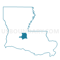
Precinct 1-26, St. Landry Parish, Louisiana
About
Outline

Summary
| Unique Area Identifier | 590583 |
| Name | Precinct 1-26 |
| County | St. Landry Parish |
| State | Louisiana |
| Area (square miles) | 7.57 |
| Land Area (square miles) | 7.51 |
| Water Area (square miles) | 0.06 |
| % of Land Area | 99.24 |
| % of Water Area | 0.76 |
| Latitude of the Internal Point | 30.51692850 |
| Longtitude of the Internal Point | -92.01261540 |
Maps


Graphs
Select a template below for downloading or customizing gragh for Precinct 1-26, St. Landry Parish, Louisiana


Neighbors
Neighoring Voting District (by Name) Neighboring Voting District on the Map
- Precinct 1-26A, St. Landry Parish, LA
- Precinct 1-28, St. Landry Parish, LA
- Precinct 1-28A, St. Landry Parish, LA
- Precinct 1-6, St. Landry Parish, LA
- Precinct 3-1, St. Landry Parish, LA
- Precinct 4-12, St. Landry Parish, LA
- Precinct 4-3, St. Landry Parish, LA
Top 10 Neighboring County Subdivision (by Population) Neighboring County Subdivision on the Map
- District 7, St. Landry Parish, LA (7,391)
- District 6, St. Landry Parish, LA (7,347)
- District 9, St. Landry Parish, LA (6,190)
- District 2, St. Landry Parish, LA (5,123)